Scientist of the Day - Robert Mallet
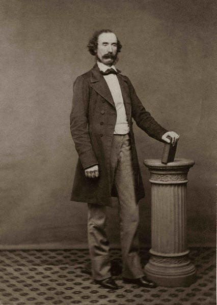
Robert Mallet, an Irish engineer and geologist, was born June 3, 1810, in Dublin. Mallet was the founder of seismology, inventing the word and setting out all the parameters of the science. In a famous paper of 1846, he defined an earthquake as an elastic compression of rock, radiating out from an epicenter caused by a displacement of the earth's crust. It is hard to beat that for a definition, even today.
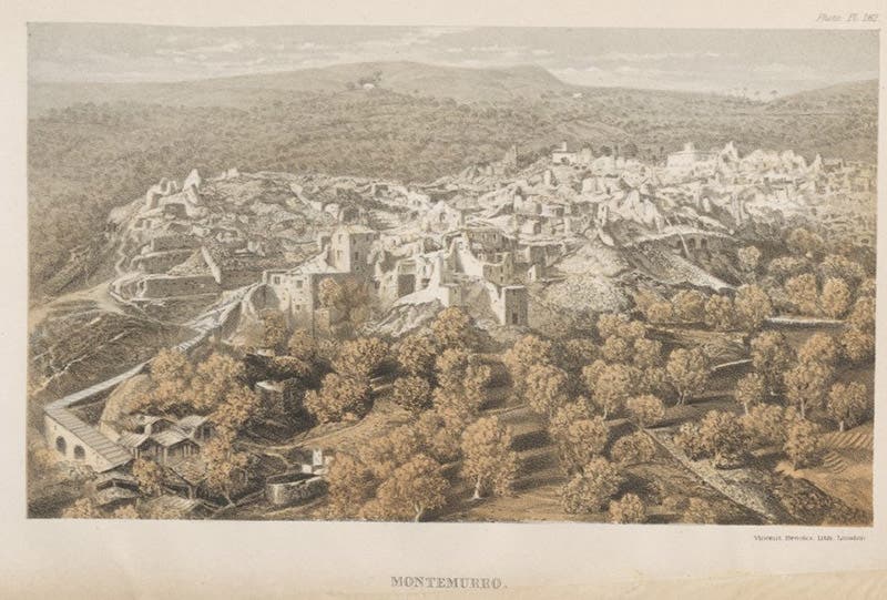
The Great Neapolitan Earthquake of 1857 gave Mallet a chance to put his theories about earthquakes into practice. The quake struck the province of Salerno, south of Naples, in the region of Italy called Campania. It occurred on Dec. 16, 1857, with an epicenter near Montemurro, and it was the most devastating seismic event of the century. About 10,000 people died. Despite its name, the earthquake did not affect the city of Naples.
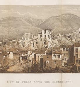
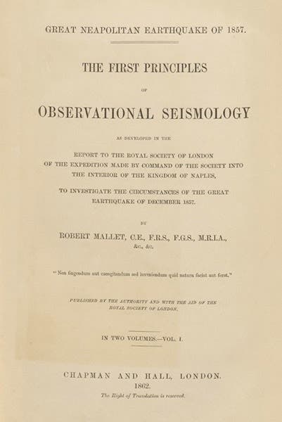
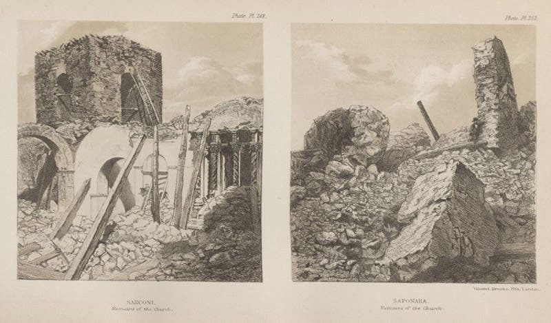
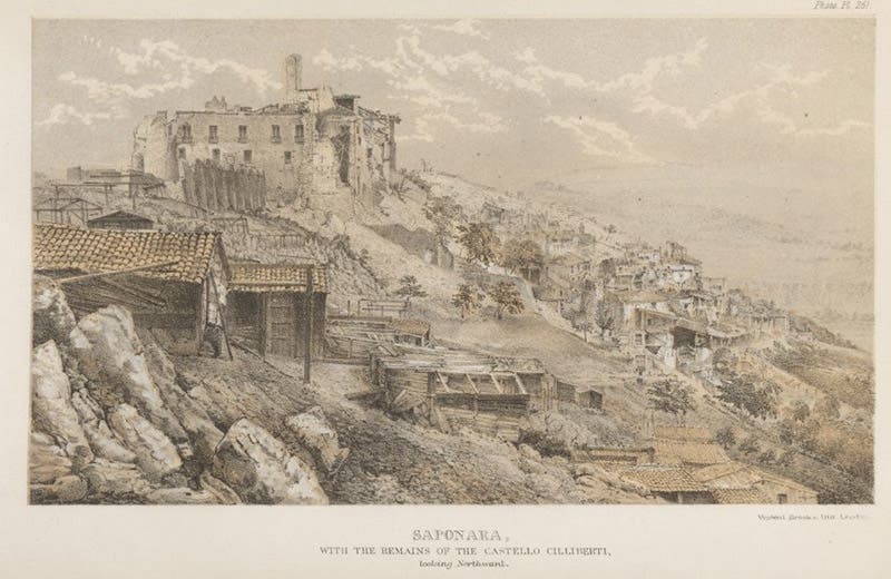
Mallet believed that one could learn a great deal about earthquakes by studying the region and the collapsed buildings, noting such things as the direction of chimney falls and the orientation of cracks in walls, to determine how seismic waves propagated. He petitioned the Royal Society of London for financial support to send him to Campania. The Society agreed, and off Mallet went. Once in Italy, he was savvy enough to hire a photographer (this was not a common practice in 1858, with studio photography only 19 years old and field photography practically nonexistent). He spent some three months in southern Italy, mapping the region carefully, and most significantly, taking an abundance of photographs, the first time that photography had been called upon in the service of seismology. When he returned, he set about writing and preparing for publication a sumptuous two-volume work, Great Neapolitan Earthquake of 1857: The First Principles of Seismology. The book did not see the light of day until 1862, due to the cost of printing the photographs, but when it did appear in print, it was a blockbuster. It is the pioneering work of seismology, which word Mallet was foresighted enough to include in the title.
We have two copies of Mallet's book in our History of Science Collection, but neither, I am sorry to say, is in very good shape. Still, it is a pleasure to leaf though it, with tinted photo-lithographs abundantly distributed throughout the text, some of which we show here. The original photographs, hundreds of them, were all deposited with the Royal Society in London, and although it seems like a large number were published in the book, in fact only a small fraction of the total could be included. Many of the originals were stereographs, but as far as I could discover, no stereo pairs made it into the book.
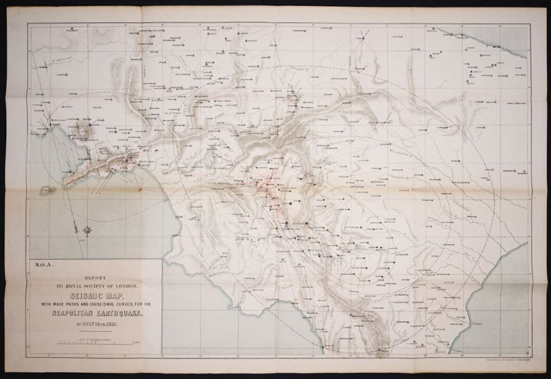
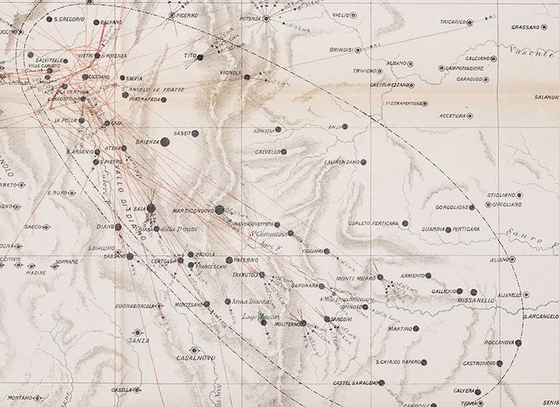
There are also two large maps, which were folded up and slipped inside the boards of the front and rear covers of volume 2, so disguised that I had trouble finding them, and even more trouble extracting them. We scanned just the one in the pocket of the front cover, what Mallet called a "Seismic map with wave-paths and isoseismal curves", coining another word – isoseismal (seventh image, below). We show a detail of the map (eighth image, below), so you can find some of the names of the devastated towns – Polla, Saponara, Sarconi – recorded by the photographer, as well as see more easily the isoseismal curves.
Mallet was, surprisingly for a Dubliner, buried in London, in the beautiful West Norwood cemetery, sharing the ground with the scientific likes of Henry Bessemer, Gideon Mantell, and John Newlands. I could not find a photograph of Mallet’s memorial or his grave. The elegant wrought-iron railing that surrounds Trinity College Dublin was fabricated by the foundry run by Robert’s father John and himself, and the label “J&R Mallet” stamped into the base may have to serve here as his monument.
Dr. William B. Ashworth, Jr., Consultant for the History of Science, Linda Hall Library and Associate Professor emeritus, Department of History, University of Missouri-Kansas City. Comments or corrections are welcome; please direct to ashworthw@umkc.edu.

