Scientist of the Day - Martino Martini
Linda Hall Library
Linda Hall Library
Linda Hall Library
Linda Hall Library
Linda Hall Library
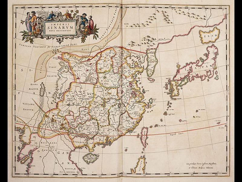
Martino Martini, an Italian Jesuit, was born Sep. 20, 1614. Martini was one of many Jesuit missionaries of the 16th and 17th centuries who journeyed to China and, while waiting patiently for an opportunity to convert the Chinese to Christianity, tried to understand Chinese culture and history. Martini's specialty was geography, and over the course of a 12-year stay in China, Martini compiled an atlas of the Far East, incorporating not only his own travels but also knowledge gained from studying Chinese maps. He returned to Rome via the Netherlands in 1654, and while in Amsterdam, he persuaded Joan Blaeu, the great Dutch cartographer, to publish Martini's atlas of China. Blaeu was just issuing volume 5 of a large folio Atlas, and he agreed to add Martini's Novus Atlas Sinensis as volume 6 of the set. It was published in 1655, and contained 17 large maps, one of the entire region and 16 additional maps showing individual Chinese provinces, as well as south-east Asia and Japan. Martini was the first to show Korea as a peninsula, instead of an island, and the first to correctly situate Japan as a near neighbor of Korea and China. In 1662, Blaeu published another world atlas, this time in 11 volumes, and for this project he re-issued Martini’s atlas as part of volume 10. This is the set that we have in the History of Science Collection.
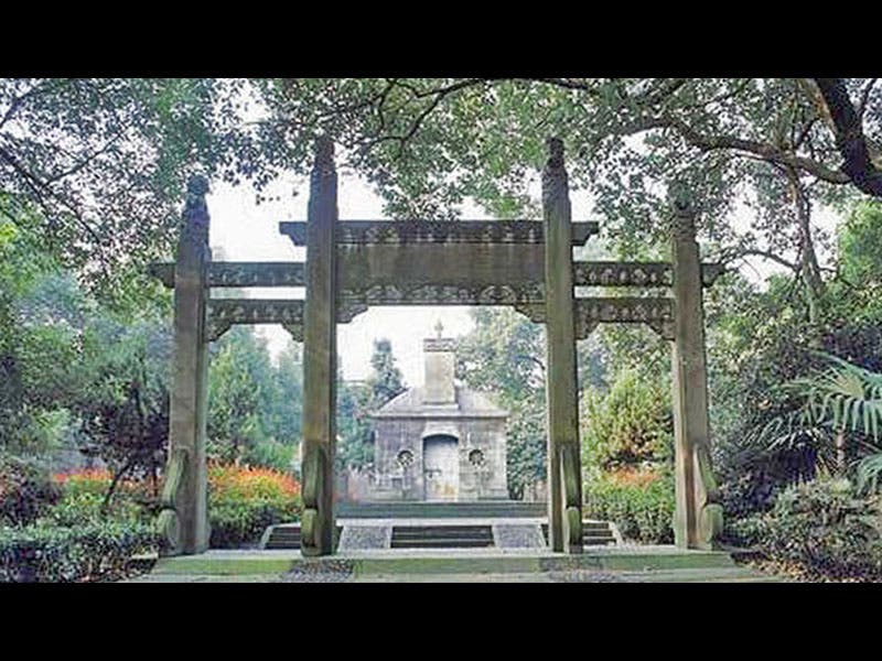
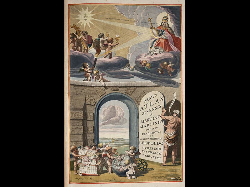
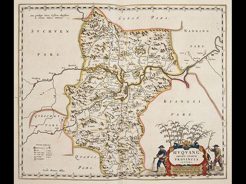
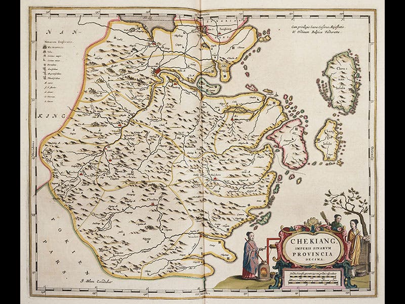
The maps above were all scanned from our 1662 edition, and include the engraved title page (second image), a map of all of China (third image), a map of Huguang province, with a title cartouche depicting rice culture (fourth image), and a map of Chekiang (now Zhejiang) province, with a cartouche showing silk spinning (fifth image). Chekiang contains the city of Hangzhou where Martini lived while in China, and to which he returned in 1658 and where he died in 1661. His memorial in Hangzhou is well cared-for (sixth image).
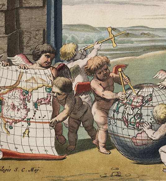
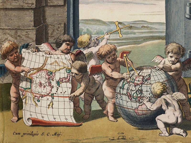
Our first image is a detail from the engraved title page, where various putti display a globe with Martini’s new rendition of the Far East, and his map of China.
Dr. William B. Ashworth, Jr., Consultant for the History of Science, Linda Hall Library and Associate Professor, Department of History, University of Missouri-Kansas City. Comments or corrections are welcome; please direct to ashworthw@umkc.edu.

