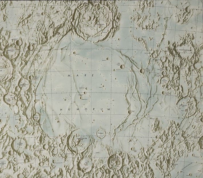
Lunar Chart: Mare Humorum.
– St. Louis: Published for United States Air Force, 1962. (Lunar Charts and Mosaics, LAC-93).
The success of the Lunar Photographic Atlas inspired the U.S. Air Force to embark on the project of producing detailed charts of the moon based on the same photographs used by Kuiper. With the exception of Lohrmann and perhaps Mayer, this was the first time that professional cartographers had been called on to deal with the problem of mapping the lunar surface. The moon was divided into 68 quadrants (although the numbers run from 1-144, since the far side was included in the numbering system), and the first two maps appeared in 1961. Eventually, 44 charts were published, until the project was superseded by later efforts. The maps are on a scale of 1:1 million, equivalent to a moon over eleven feet in diameter.

The map of Mare Humorum (Sea of Humors) contains a variety of lunar surface features. Most notable are the wrinkle ridges to the right of the mare basin. The crater Gassendi is at top left; it may be compared with the photobase drawing by Krieger (see item 29). However, to make the comparison, one of the illustrations must be inverted, for the Air Force maps place north upward, ending the long-standing tradition of depicting the moon with south at the top. Image source: Kuiper, Gerard Peter, D. W. G Arthur, et al. Mare Humorum. St. Louis, Mo: Aeronautical Chart and Information Center, United States Air Force, 1962.

