Pickering, William Henry (1858-1938).
The Moon: A Summary of the Existing Knowledge of our Satellite. – New York: Doubleday, Page & Company, 1903.
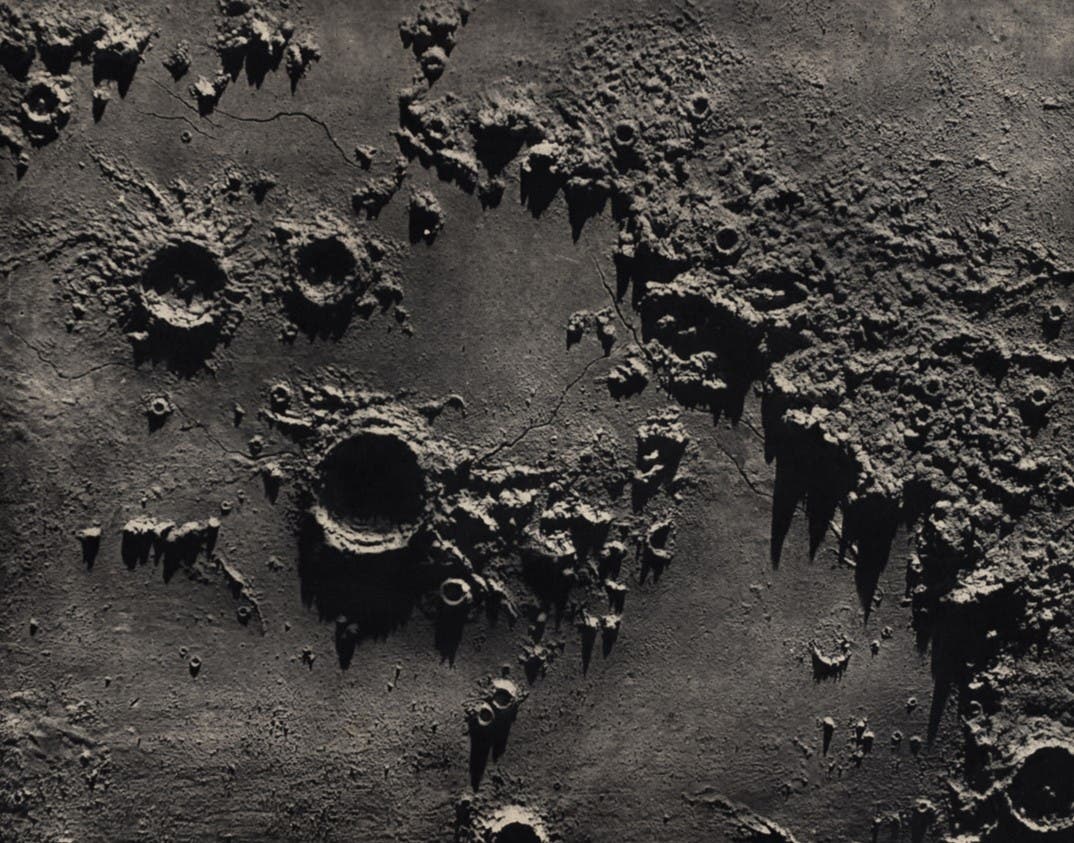
When Pickering began his work, three photographic atlases had been attempted, and all had encountered difficulties or criticism: the Lick atlas had been discontinued; the Paris atlas had no orderly arrangement or consistent scale; the Weineck atlas was too expensive. Pickering decided to produce a systematic, affordable atlas, with every feature covered five times, under different angles of illumination. All the plates were to be at the same scale, and the same size as the original negatives. The photographs were taken in 1901 in Jamaica especially for this atlas. Pickering's atlas (which was also issued as part of the Annals of the Harvard Observatory) may not be as physically impressive as its competitors, but it was much more useful for the lunar observer, and it established the standards which most later atlases would follow.